blah blah blah
North Deer Mountain
Length: 4.0 miles out-and-backDifficulty (click for info): Easy
Elevation Gain: 1010 feet (+60 feet on return)
Rating (click for info): 7/10
Elevation: 2997'
Prominence: 107'
Driving Directions:
Trailhead and parking area are on Sophie's Lane in Pittsburg, NH. Sophie's Lane is a logging road that begins on the west side of Rt. 3, 3.8 miles north of the Second Connecticut Lake Dam and 0.1 miles south of Deer Mountain Campground. Watch mileage carefully, as the entrance to the road is not well-marked. Look for the kiosk just in from the main road. Drive 0.6 miles down the rough dirt road and turn left onto a narrower road at a sign for Deer Mountain Fire Tower. Continue 0.2 miles up the unnamed road and park in the large clearing at the end. The trail begins at a sign and register box on the left side of the road at the entrance to the clearing. Click here for a Google map.
About the Hike:
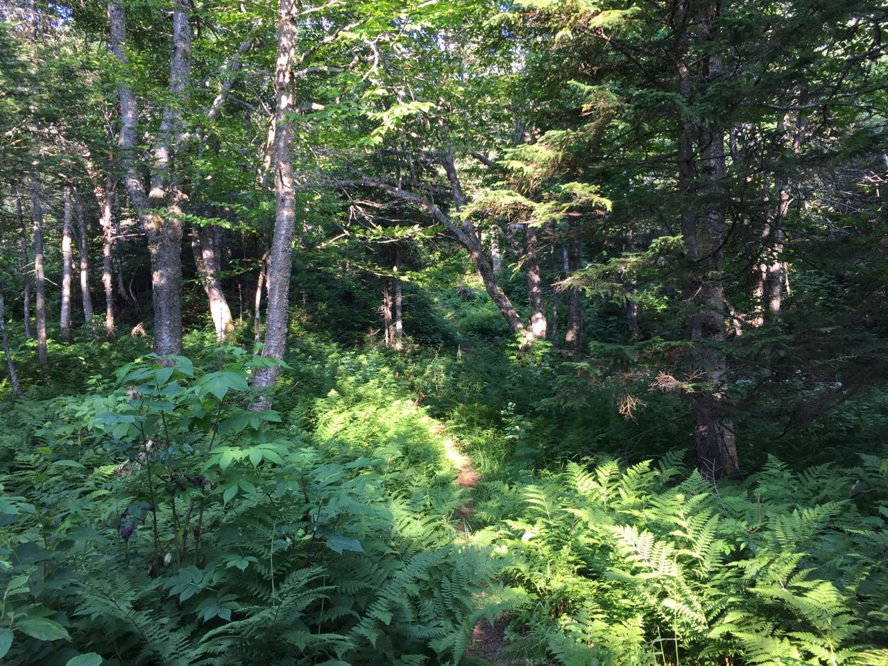
The recently-opened Deer Mountain fire tower trail is one of the northernmost maintained hiking trails in New Hampshire. A spur of the 162-mile Cohos Trail, the wild, winding mountain path provides access to the site of the former fire tower on the north peak of Deer Mountain. A prominent feature of northern Pittsburg, Deer Mountain rises to the west of Rt. 3 to the south of the Third Connecticut Lake. Its slopes are covered with some of the most astoundingly beautiful northern forest you will ever see in New Hampshire. The summit itself is not reached by any hiking trails, but the trip to the old tower on the north knob takes in small cascades and rapids along a nameless brook, a scenic beaver pond on a high shoulder of the mountain, peaceful fern glades, and moss-draped spruce forest. All of it is reached by the mainly gentle Deer Mountain Fire Tower Trail, which is well-marked with blue wooden blazes.
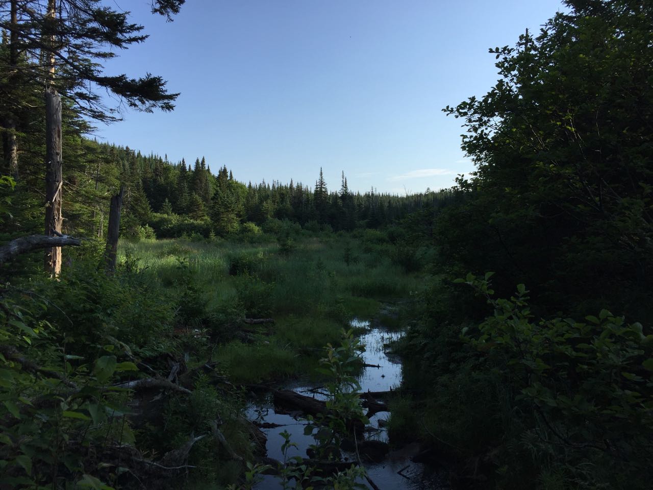
From the trailhead, sign in at the register box and head out on the trail. The narrow path immediately heads toward a brook and follows it, closely at first but later out of sight. You will pass several small, mossy cascades and travel through some fine birch stands. The trail climbs gently for 0.3 miles to its first crossing of the brook. Hop across the gravel and stones and continue beside the brook on the other side. In just 0.1 miles, the trail re-crosses the brook back to the north side. The trail continues in proximity to the brook for a bit, passing an interesting small gorge, then pulls away after 0.1 miles. Grades remain easy as you ascend through the gorgeous spruce and birch forest through hobblebush and ferns. After 1/4 mile more, the path nears the brook again as it makes a long, sweeping turn to the north. It continues for 0.15 miles at even easier grades - watch for the trail carefully as you pass through a blowdown area - to a third crossing of the brook, this time on a wooden bridge. Just beyond, the trail comes out to the edge of a pretty beaver pond which the brook flows through, filled with grasses and surrounded by spruce trees.
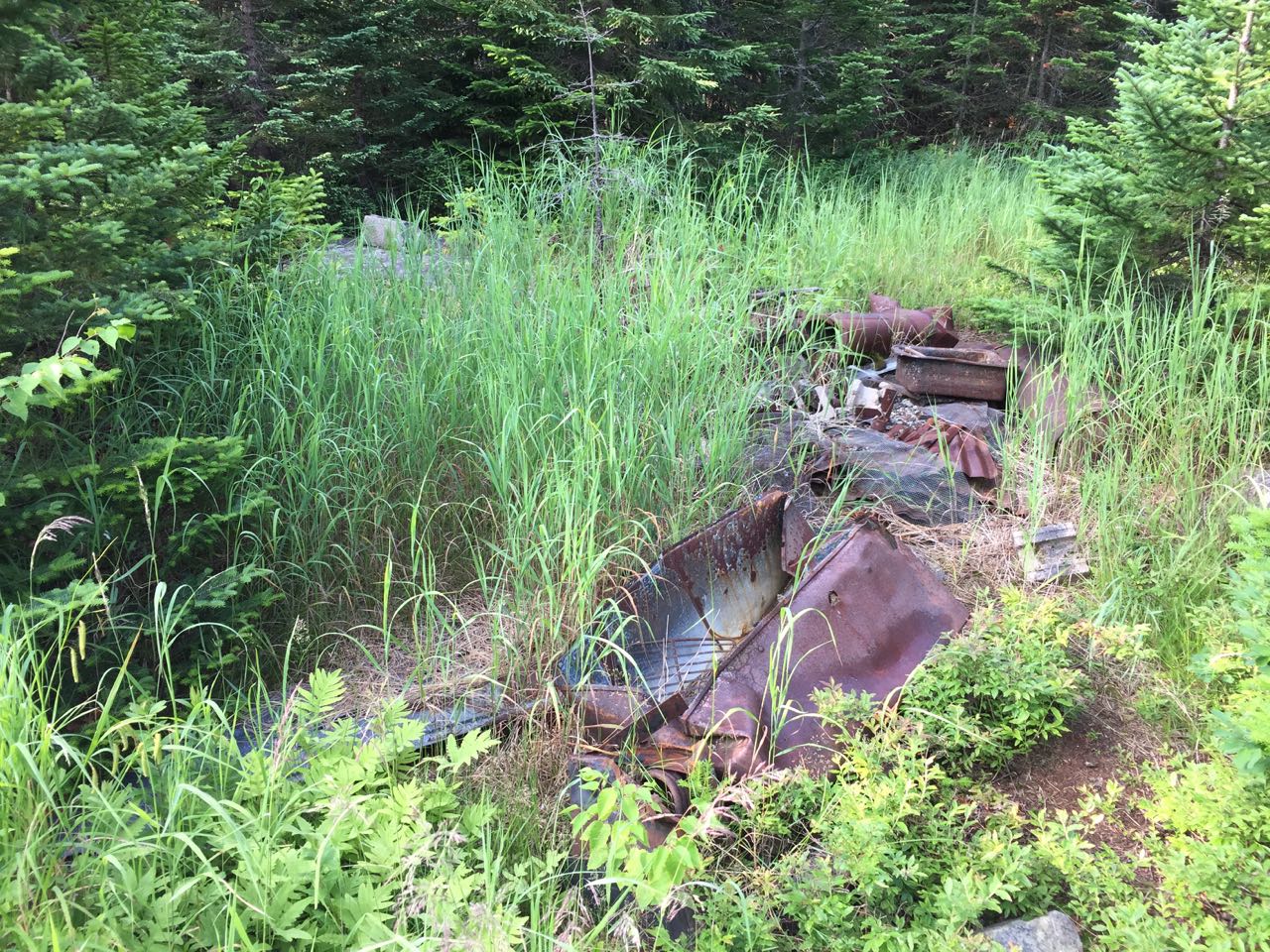
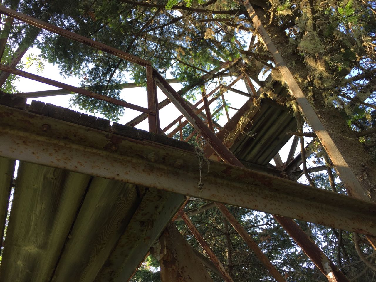
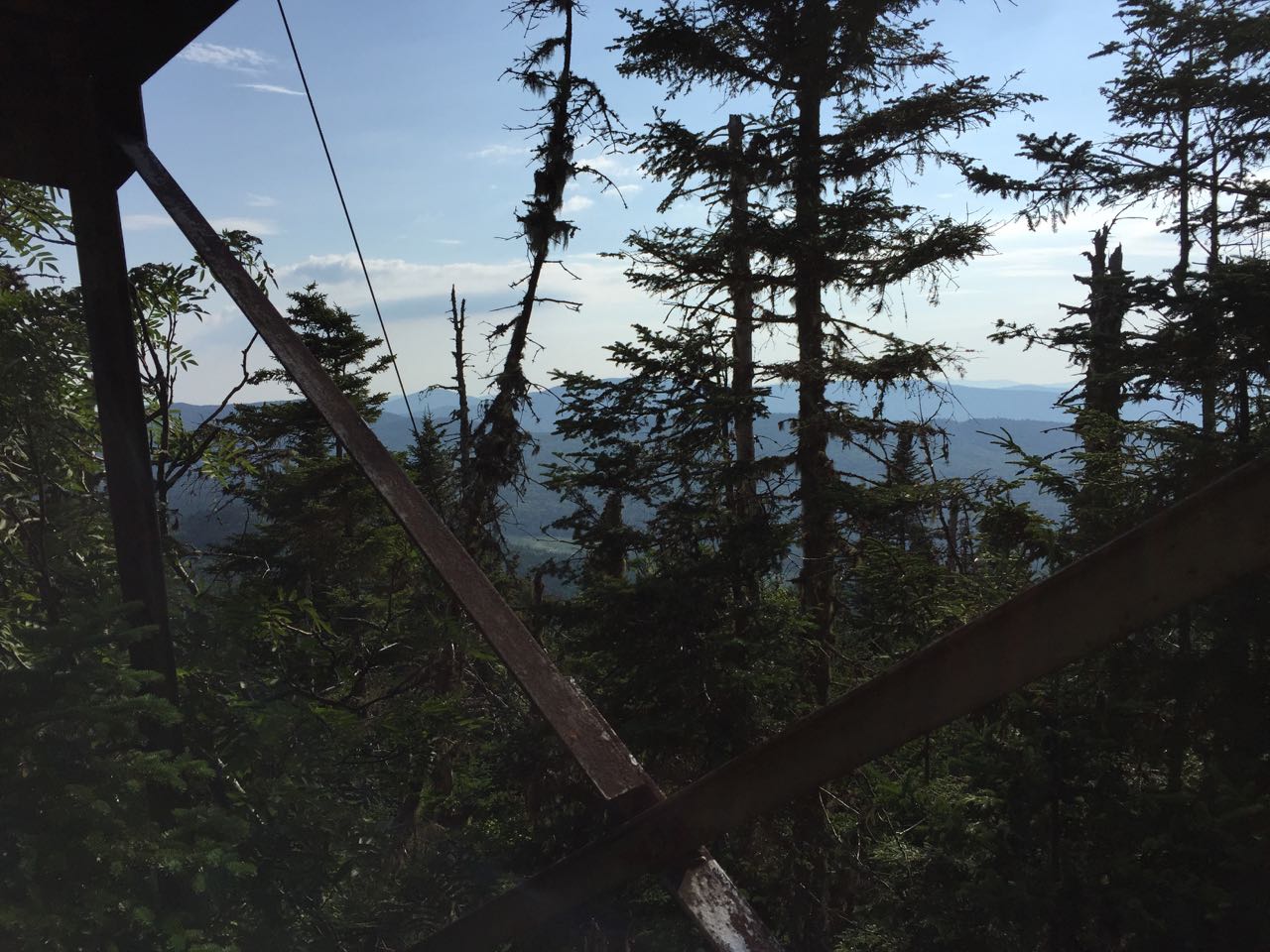
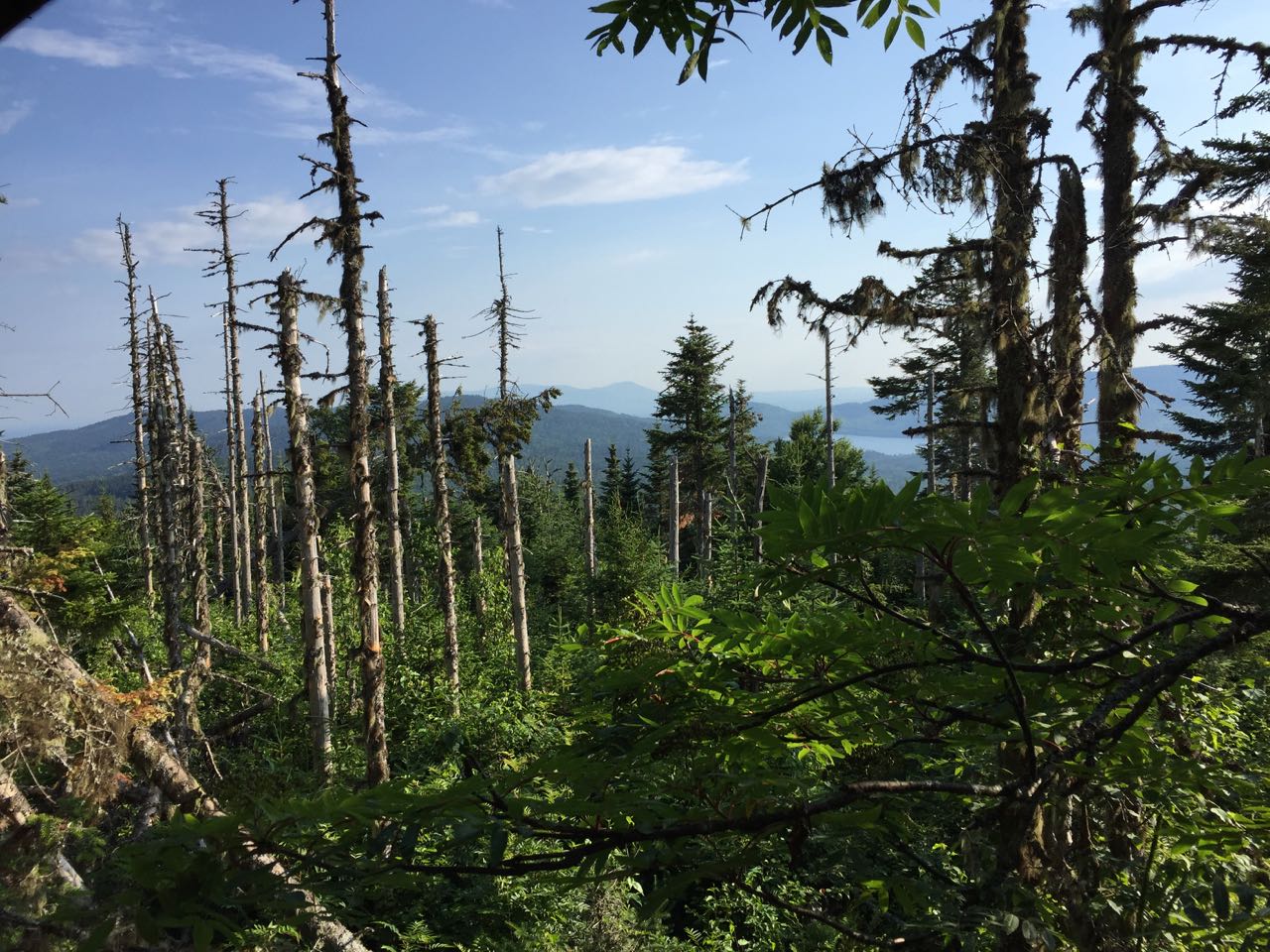
The trail follows the edge of the wetland for 0.1 miles, then crosses the brook for the fourth and last time in a gravelly and often-dry area, where there is a tall cascade in view upstream. It then makes a long switchback up a very steep slope, reaching a plateau in 0.1 miles and coming back to the brook above the large cascade. The trail heads across the mostly-flat plateau for 0.2 miles, crossing a muddy area on bog bridges and reaching a beautiful open birch glade just before the next short climb. It begins climbing through the ferny glades, then goes back into darker spruce forest, ascending 0.2 miles at moderate grades. The trail then crosses the main ridge of Deer Mountain, leading across a northern shoulder to the west side, and makes an easy 60-foot descent to the col below the north peak in the next 0.3 miles. Just past the low point, you will pass through a small grassy clearing, where you can explore the remains of the old fire warden's cabin. Find piles of rusted metal and preserved barrels, sinks, and bedsprings. Beyond this, the trail climbs easily once again through amazing open woods for 0.2 miles, leading up a final fern-filled corridor to the summit of the north peak, where the remains of the fire tower comes into view. The rusted metal frame of the tower stands in a clearing just behind a blowdown patch. The cab of the tower has long gone, and the wooden steps of the tower are missing too, making the structure impossible to climb safely. Aside from the bizarre sight of this huge, dilapidated structure in the middle of the forest, you can also peek through the dead trees in the blowdown patch to see minimal views of the area, including the Third Connecticut Lake and Mont Megantic across the Canadian border.
Printable directions page